Improved presentation of borehole data
15 January 2024
An effort has been made to improve the presentation of borehole data at Orkustofnun’s web page. The borehole registry data can be reached at Orkustofnun‘s home page www.os.is/en and at the Orkustofnun’s geoportal www.map.is/os
The information related to each borehole has been grouped together and therefore it is easier to find the information that each one is looking for. Example:
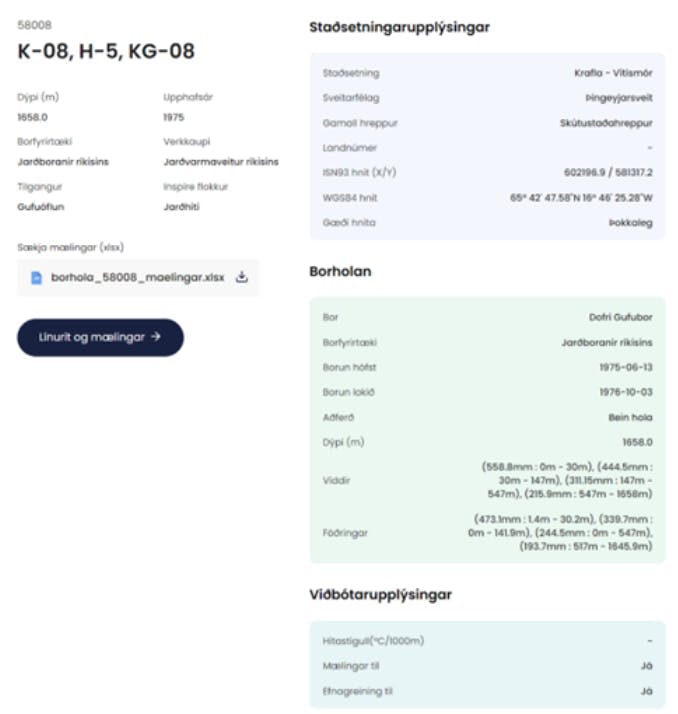
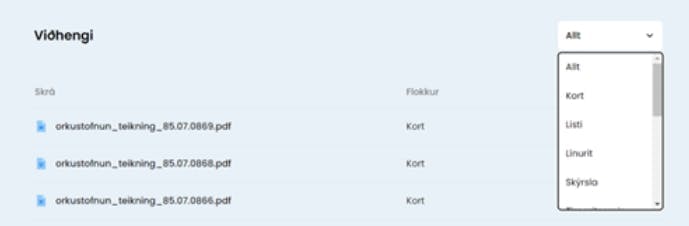
It starts with general information on the borehole, then location information, description of the borehole and finally additional information. In the borehole description, widths and casings were made more extensive so that all the information that is kept in the database is visible. All documentation that has been linked to the borehole is also accessible.
Work was done to present measurements in a clear and concise manner. You can download all measurements as an Excel document, but they can also be viewed by clicking the button:

Then a page appears with the measurements and graphs. Example:
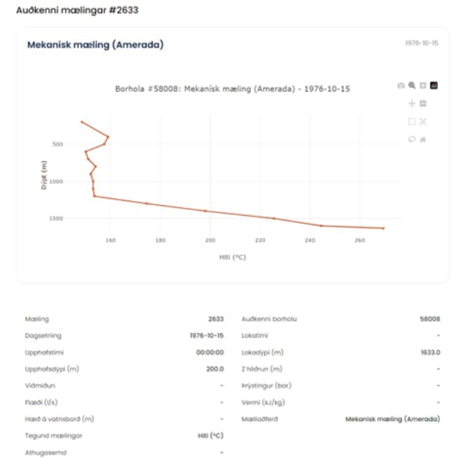
The graph is interactive, so individual values can be read, and you can zoom in or out.
There is a lot of work to be done to finish entering all the data that is available in Orkustofnun, and we also need help in improving the data that is already available. All fresh information or identification of mistakes in the data is welcome. Comments can be sent to borholur@os.is.
API access to Orkustofnun’s data
There is now API access to Orkustofnun’s data at docs.orkustofnun.is. You can electronically fetch a great portion of Orkustofnun’s data. It varies how often this data is updated; some are updated daily while others are more or less static. We will try to add more datasets in the coming months to improve still Orkustofnun’s service to professionals and others that are interested in data related to Iceland’s resources.
Among the datasets that are already accessible are:
- Orkustofnun’s map collection
- Orkustofnun’s (and predecessors) technical drawing collection
- Issued licenses
- Boreholes
- Laws and regulations that apply to Orkustofnun